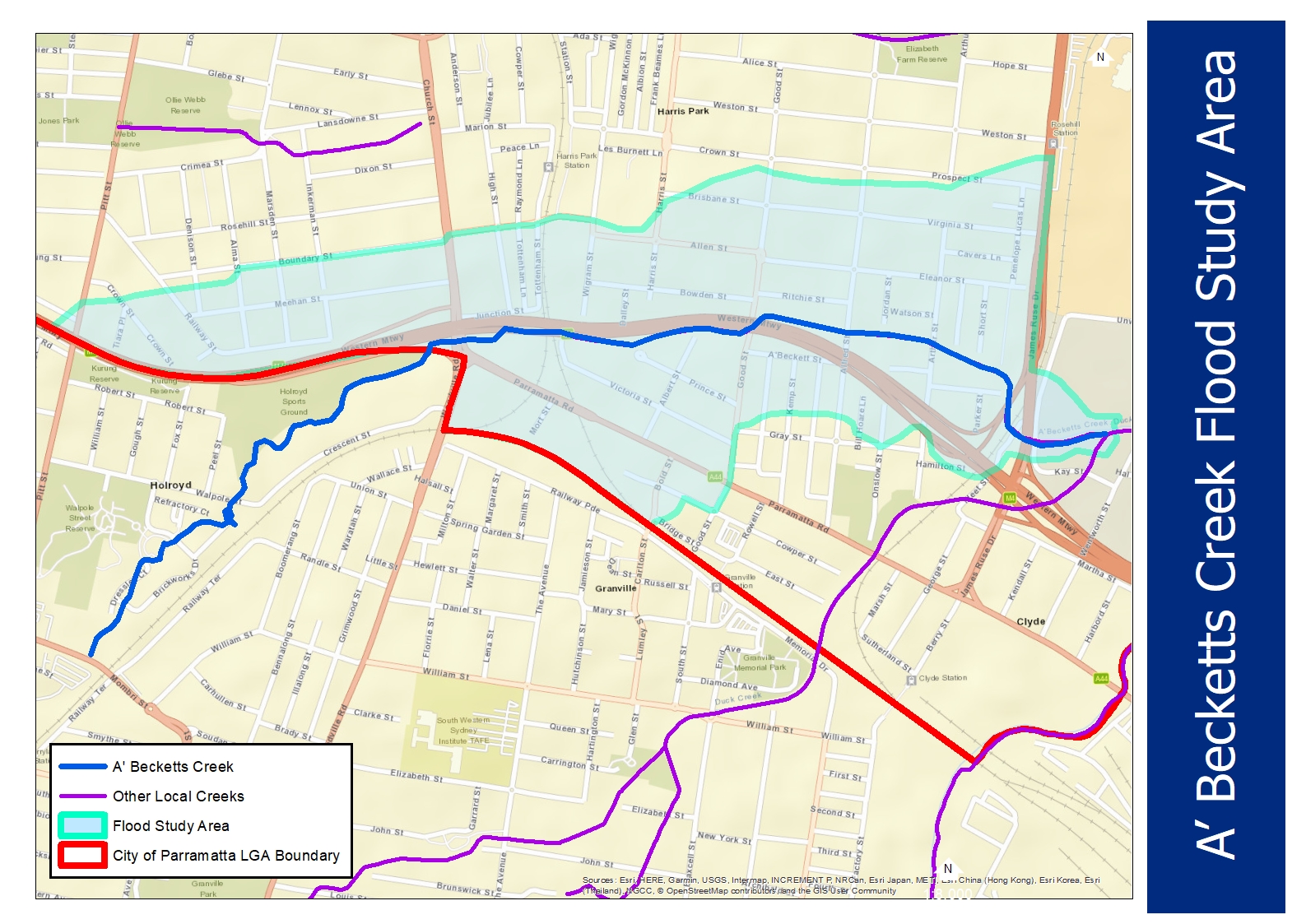
Following data collection in 2022, technical consultants are now using information provided by residents and other materials to build a draft flood model. It is anticipated that the Draft A’Becketts Creek Flood Study will be on public exhibition in early 2025.
Residents in Granville, Harris Park and Rosehill contributed to the initial phase of the study and when the draft flood model is ready, residents will be asked to review the modelling and meet with Council to discuss how the flood study interprets the behaviour of flood water on their property.
Flood studies support our work to issue flood warnings, respond to emergencies, and manage development. The information provided by residents assists Council to understand any existing local flooding problems and help us plan and resolve, or reduce, the impact of flooding in your area.
Council will provide more information on how and where to have your say on the Draft A’Becketts Creek Flood Model on our Participate Parramatta project page.
In addition to progressing work on the A’Becketts Creek flood model, City of Parramatta has been working on capturing data and setting up additional monitoring in order to expand its award-winning FloodSmart Service into the A’Becketts Creek catchment.
Expected to be live in mid-2024, the FloodSmart service sends warnings and information about flood conditions in real time. Subscribers to the free service can choose to receive updates vis SMS, email or voice message.
Council will provide more information on how to subscribe once the monitoring system for A’Becketts Creek has been tested and is live.
Visit FloodSmart for more information on the FloodSmart Service (currently monitoring 10 sites).
In 2022 the City of Parramatta undertook an extensive study of A’Becketts Creek to better understand the impacts of flooding in your neighbourhood, this was stage one of the flood study.
What is the study about?
The study is the first step in developing a flood model.
We’re looking for information that will help us map the flow of water in various flood events and hoping locals will share information about flooding, whether flood water was on roads in your neighbourhood, in local parks or if water entered your garden or home.
There is a short 5-minute online survey about any localised flooding you have seen around the A’Becketts Creek area including where the water travelled, its depth and how long before it subsided. To find out more visit Participate Parramatta.
What is a flood model?
Flood models use various technologies to map the movement of water including predicting risk and hazards. Flood models help predict flood behaviour and support Council’s work to manage flood risk to existing and future properties, and our community.
There are several benefits provided by the new flood study including:
- providing Council with an understanding of flood behaviour across its catchment areas to enable appropriate management of flood risk for existing and future development
- helping landowners understand their flood risk so they can be better prepared for flooding.
- helping emergency services (e.g. NSW State Emergency Services (SES) and Police) understand the impacts on people’s safety when various levels of flooding occur
- Providing FloodSmart Parramatta the information it needs to provide your community with flood warnings.
Council has a responsibility under the NSW Department of Planning and Environment, Floodplain Risk Management process to gather accurate information and develop a flood model.
An invitation to complete this flood survey does not imply that your home is flood affected.
To join the study and complete the survey visit Participate Parramatta.
For more information:
Please see the A’Becketts Creek project on Participate Parramatta. You’ll find information including responses to frequently asked questions.


